

Hiking Australia’s tallest mountain.
Why rent a car, drive 5 and a half hours from Sydney, use up 2.5 days of vacation just to do a 12 mile hike? Well does it entice you any extra if you know that Mt. Kosciusko happens to be the highest point on the entire Australian continent? Because thats exactly what drew us in! 2 years ago we went on a trip to Tanzania to summit Kilimanjaro, the highest point in Africa and knowing that we we just hours away from another one of the Seven Summits we had to do it putting our number at 2. If we aren’t goal oriented we aren’t Krajiceks. #FACTS
Unlike Kili where you push your body through uncomfortable terrain, weather and sleeping conditions for over a week Kosciusko is an easy and enjoyable day stroll with several options to make your trek even easier if you wish. We met school kids on field trips, tour groups of an older age bracket and even chatted up a 3 year old at the summit. Most of those guys chose the easiest option to summit, we also came across people with legit backpacking equipment that seemed to be on a much longer quest than just this one peak.

We showed up only slightly prepared… The weather here in February is chilly in the morning but hot in the day time with a cold breeze at the top. We hadn’t packed true hiking gear but I did have my trail running shoes and Jake just wore his day to day tennis shoes. As always on mountains, I suggest layers for the changing climates. Going through my pictures it looks like I had multiple wardrobe changes from adding and taking away layers!
I’ll give you a few details about the different route options but if you are inspired and seriously considering this summit I highly suggest checking out the NSW National Park website www.nationalparks.nsw.gov.au during your planning for more detailed information but here’s the gist:
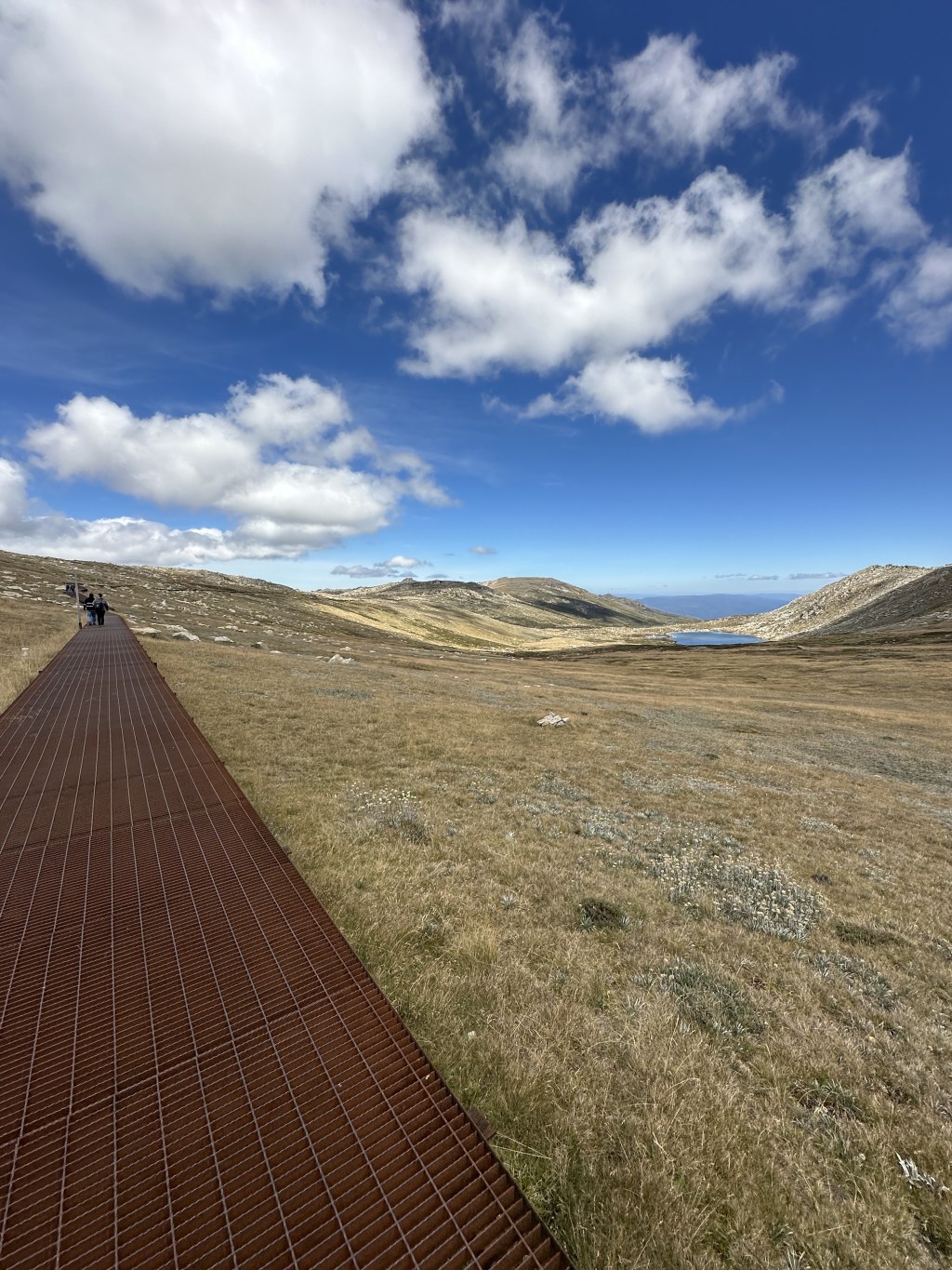
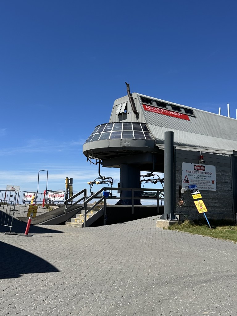
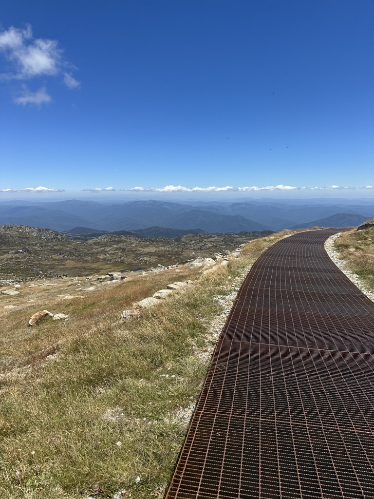
1. (Easiest) Chairlift to Summit Trail – Starting at the ski town of Thredbo hop on a chairlift and ride through the scenic forrest until making the start of your hike just 4 easy miles away from summit, 8 miles there and back to the chairlift down. The entire path is either steel grate or granite rocked pathway and not much elevation gain. Its a steady easy walk. We did see a road driving up to Charolette’s Pass only 1.4k from summit but we didn’t witness anyone using that road leading us to believe that it was for Park Rangers not trekkers.
2. Thredbo to Summit – Roughly 12 miles out and back, this is the route we chose once we realized the trailhead was just outside our accommodations. Basically where in option 1 the chairlift carried people up we did it by foot. This route should be nicknamed stair stepper because that is exactly what it felt like if the stairdtepper had a setting for uneven and variable steps times 4 miles! Once we finally arrived at Eagle’s Nest we made our way over to the Summit path where most people started their trek. In fact, we only saw 1 other hiker on our way up! With our legs burning the other trekkers fresh off the lift we must’ve looked sweaty and out of breath but hey we felt like we were earning that summit! The grated path was a welcomed joy and we took a few opportunities to break and just take in the scenery.
The mountain does not look like most, usually you hike at a gradual steepness and then push for the peak, this was more of a push at the bottom with slow steady hills at the top. The current theory scientists believe behind this unusual mountain top is that instead of being created by tectonic plates shifting like most ranges this one was created is that there have been 2 separate occurrences of uplifting front the Earths mantle around 100 million and again 50 millions years ago. Fun Fact: this area of the continent has unusually high gravity readings…
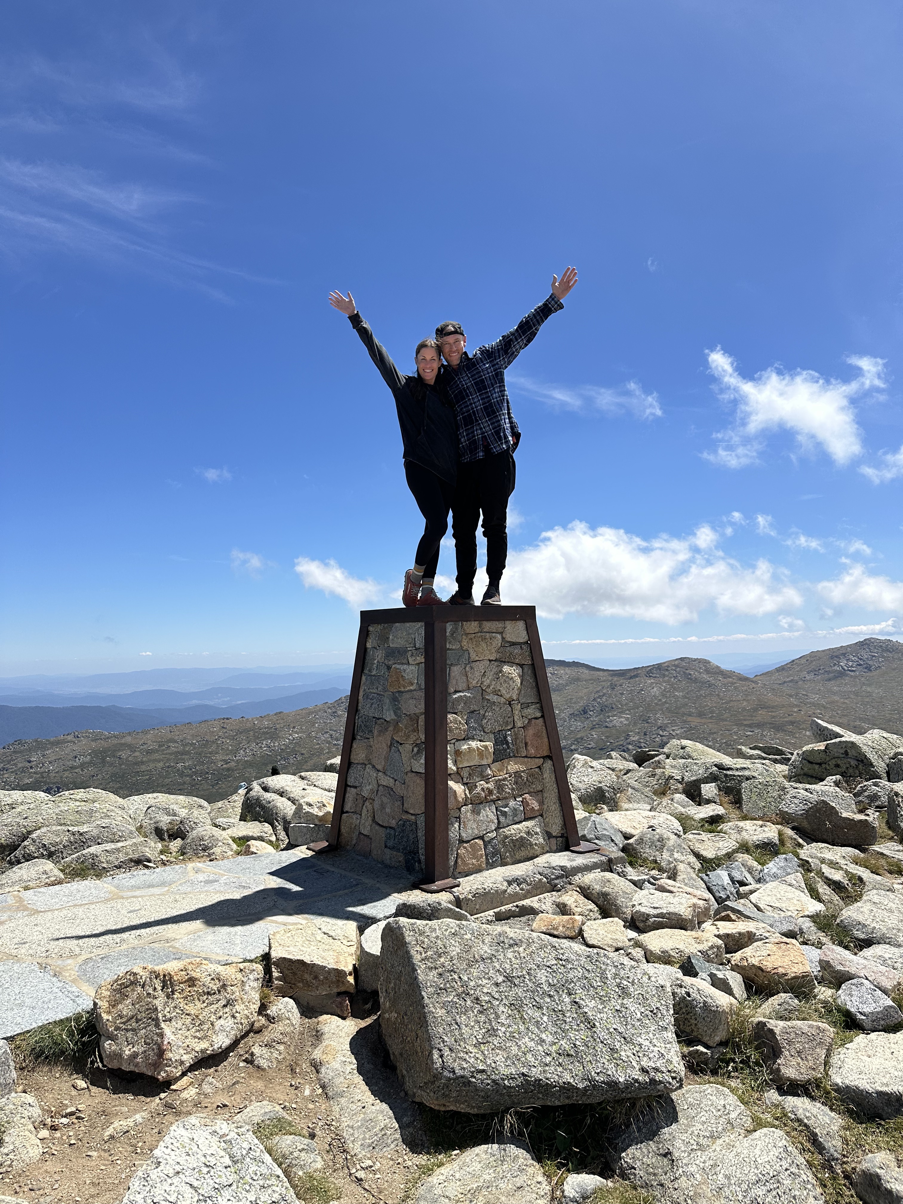
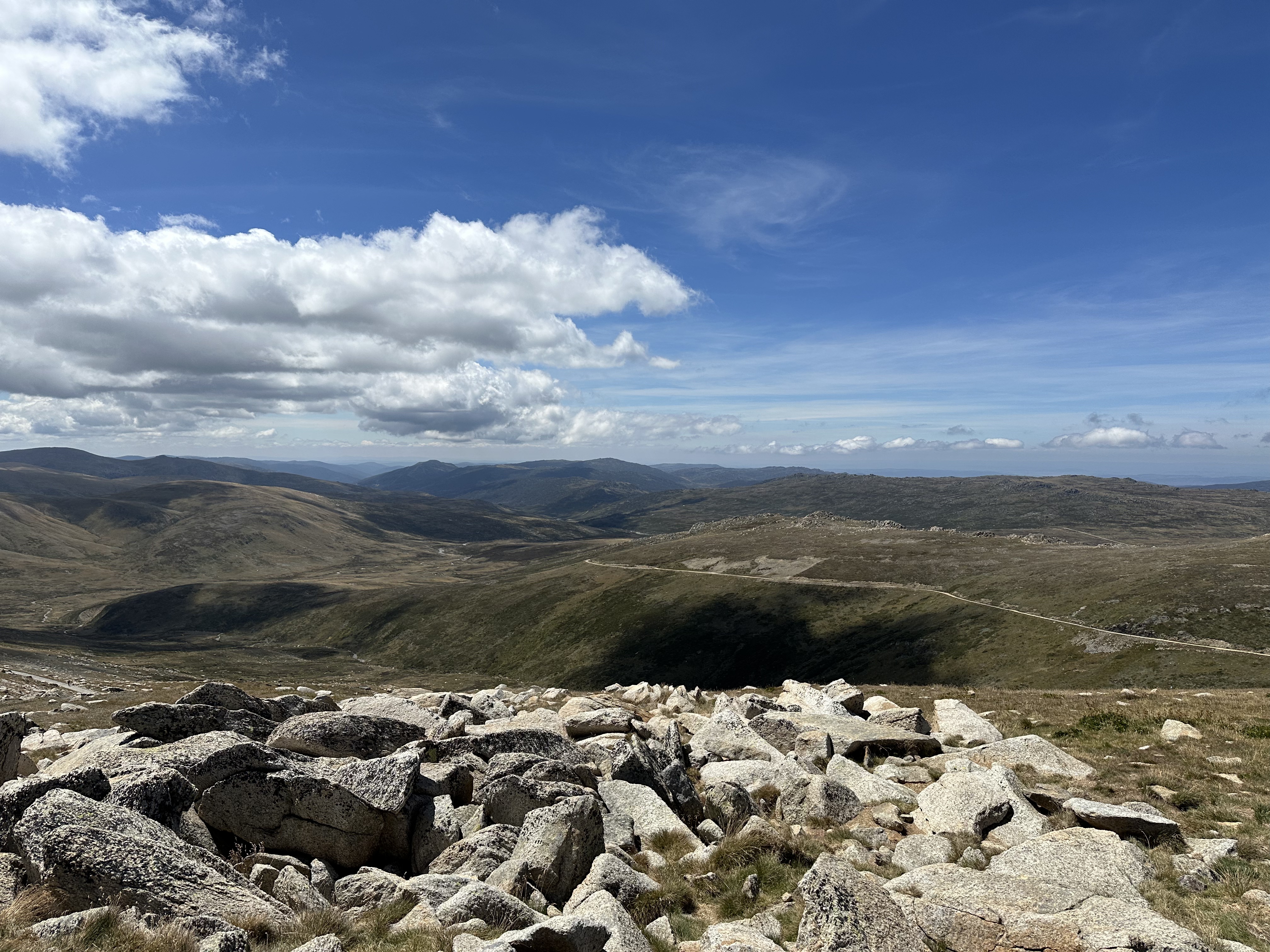
Okay, I’ve veared off a bit, back to the trail! Once at summit there is a rock structure that you can stand on to celebrate and get an even better vantage point of the valleys below it also makes for a great pic! As you head back down you have a great view of the trail and distance you’ve gone. Its a pretty quick hike back to Eagle’s Nest where we took the opportunity to hop on the chair lift and take the scenic ride down to celebrate! Back at the base there is a pizza and beer spot on a balcony with a view of the mountains! Great place to unwind and prop those feet up after a great day hike!
3. Charlotte’s Pass to Summit Walk – 11.5 miles of the most scenic version of the trek you start out at Charlotte’s Pass. The pass happens to be almost an hour drive from Thredbo even though its relatively close by foot. So you ought to make a decision about your starting point before booking your accommodation. On your path you will come across the Snowy River and the Seaman’s hut. Staples of the area and then continue on and hook up to the main trail just minutes before Summit. I cannot speak from first person but this is considered the most beautiful of the trails and it is nearly the same length as the Thredbo option so maybe it’s for you! If you go this route please reach out and let me know how it went! I’d love to see pictures!
So there you have it. Who doesn’t want to summit at least one of the Seven Summits?! ESPECIALLY after you learn how easy this one is to attain! SO next time you find yourself Down Under go ahead and do yourself a service. Become a Continental Summiter!!!
In case you would like to know our accommodation recommendation I can only speak for Pure Chalet in Thredbo, I booked on hotels.com, it was easy to find, single staffed and she was awesome, breakfasts at PC were great and the showers were even better!
Oh and one last pic of us relaxing after! Beautiful views and great pizza!

As always, thanks for joining us on our adventures. Life is what you make it, buy the ticket, take the flight… LIVE!


Leave a comment